Costa del Sol hiking and nature: choose the right level before you go
A practical guide to easy nature walks, mountain trails, protected areas and Caminito del Rey, with realistic heat, transport and safety planning.
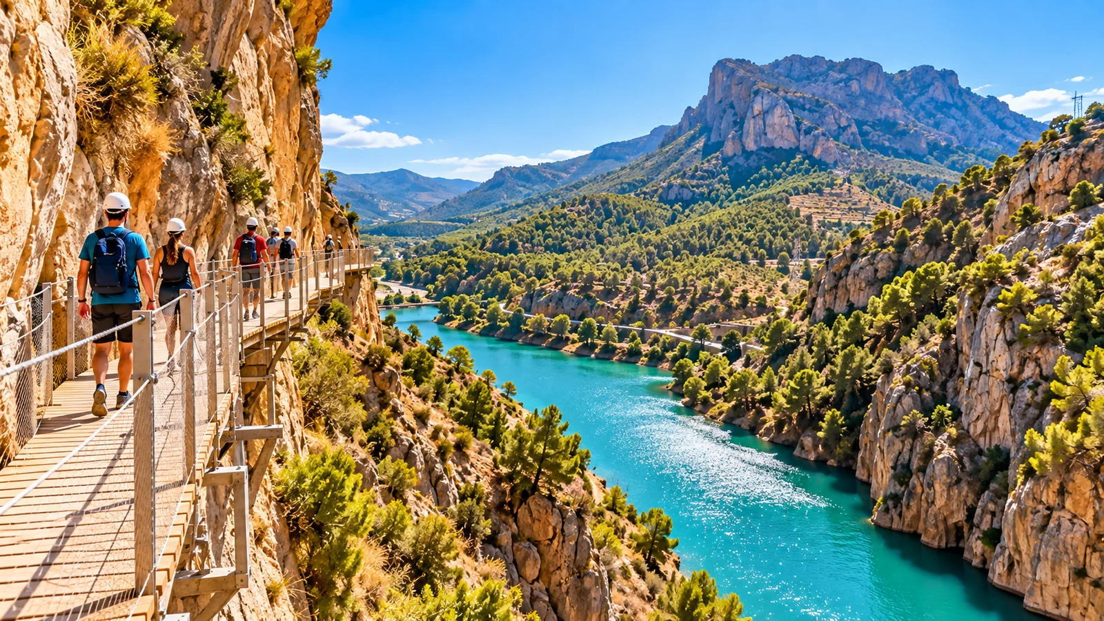
The Costa del Sol is often sold as a beach destination, but the landscape changes very quickly once you move away from the promenade. Within the wider Málaga province you can choose between short protected-area walks, marked mountain trails, serious uphill routes, national-park days and the regulated boardwalk experience of Caminito del Rey.
Those are not versions of the same activity. A family walk to a viewpoint in Maro-Cerro Gordo, a self-guided trail above Mijas Pueblo, a climb towards Pico del Cielo and a reserved visit to Caminito del Rey require very different planning.
The useful starting point is not “what is the most spectacular hike?” It is “what level of effort, exposure, transport and commitment fits this day?”
Four types of nature day
For planning, divide outdoor time into four categories.
Easy nature walk: short routes or coastal viewpoints where the objective is scenery rather than sustained effort. The official Torre de Cerro Gordo trail, for example, is listed by the Junta de Andalucía as short and low difficulty.
Marked local mountain trail: routes such as those in Sierra de Mijas, where the municipality maintains a network of signed self-guided paths. These are genuine mountain walks even when the starting point is close to a tourist town.
Demanding mountain route: climbs such as Pico del Cielo near Nerja. The municipality itself describes the route as physically demanding. This is not a casual add-on after a long beach day.
Regulated outdoor attraction: Caminito del Rey. It is a linear, one-way route with advance reservation, access rules, age restrictions and possible weather closures. Treat it as a scheduled excursion, not an improvised hike.
Once you know which category you want, the rest of the planning becomes much easier.
Sierra de Mijas: the easiest mountain network to understand from the coast
Sierra de Mijas rises immediately behind the coastal towns and gives one of the clearest transitions from resort landscape to Mediterranean mountain terrain.
Mijas tourism maintains a network of marked self-guided trails on the southern slopes, with access around Mijas Pueblo. The municipal guidance explicitly tells visitors to plan according to physical condition and notes that some orientation knowledge is useful.
That is important. A marked trail is not the same thing as an urban footpath. Heat, loose ground, elevation and route junctions still matter.
For a first mountain outing, choose a shorter route than your maximum ability. The reward is that you can combine the walk with Mijas Pueblo without turning the day into a major expedition. Start early, finish before the strongest heat and keep the village as the flexible second half of the day.
Maro-Cerro Gordo: protected coast without a full mountain day
The protected cliffs around Maro and Cerro Gordo give a different kind of nature experience. Here the interest is the meeting of steep coastal relief, Mediterranean vegetation and sea views.
The Junta de Andalucía visitor portal lists the Torre de Cerro Gordo route as a short, low-difficulty walk from the parking area. That makes it useful for travellers who want a protected landscape without committing to several hours of mountain hiking.
Do not confuse “short” with “no planning required”. Coastal heat, wind, exposed viewpoints and parking conditions still need attention. Follow the signed route, respect protected-area rules and check current access before setting out.
This type of outing works particularly well as a nature component in a Nerja or Maro day rather than as the only reason to cross the whole Costa del Sol.
Pico del Cielo: save it for a real hiking day
Pico del Cielo is one of the routes that visitors can underestimate because Nerja itself is associated so strongly with beaches.
The town has recently continued to promote the route as a recognised hiking asset, while also describing its physical demand. That is the correct frame. A summit route with major height gain belongs in a different category from walking the Balcón de Europa or visiting Maro.
If you are considering Pico del Cielo, treat the entire day around the hike. Check current route information, weather, daylight and your group’s fitness. Carry sufficient water and appropriate footwear, and be ready to turn back if conditions or pace are not right.
Do not schedule a hard mountain climb because a generic article says “Nerja in the morning, beach in the afternoon”. The mountain decides the day, not the marketing itinerary.
Sierra de las Nieves: national-park scale requires a dedicated plan
Sierra de las Nieves is a National Park in the western part of Málaga province, covering territory around municipalities including Istán, Monda, Tolox, Yunquera and others.
This is inland mountain country, not a quick seafront detour from Marbella. The driving approach, the exact trailhead and the conditions can consume a meaningful part of the day.
Choose Sierra de las Nieves when nature is the main purpose of the day. Identify one specific official route and trailhead rather than driving into the park with a vague plan to “find a walk”. Protected areas can have access restrictions, seasonal considerations and route-specific advice.
If you are staying in Marbella or Estepona, it can be a very rewarding contrast to the coast. But it should be planned with the respect you would give any mountain national park.
Caminito del Rey is not a normal spontaneous hike
Caminito del Rey is one of Málaga province’s best-known outdoor experiences, but it should be understood correctly.
The official platform describes an approximately eight-kilometre linear route, one way from Ardales towards Álora, with an estimated duration of three to four hours. Approach walking is part of the logistics. Advance reservation through the official channel is required, visitors need to arrive ahead of their slot, and children under eight are not admitted.
Weather also matters. The official operator can close access because of rain, strong wind or other safety conditions. Visitors are specifically told to check the official information, especially close to the visit.
This means Caminito del Rey should be given its own day or at least the dominant block of a day. Do not book a tight lunch or another timed attraction on the opposite side of the province immediately afterwards.
Summer changes the entire calculation
A route that feels moderate in spring can become unpleasant or unsafe in strong summer heat. Shade is limited on many Mediterranean mountain paths, and exposed rock reflects heat.
In hot months, start early and shorten your ambition. Carry more water than you think you will need and do not rely on finding a bar, fountain or shop on the route unless the official trail information explicitly confirms it.
A useful rule for visitors is to separate “I can walk this distance” from “I should walk this distance in today’s temperature”. They are not the same question.
If official warnings, fire restrictions or closures are in place, they override the itinerary.
Winter and shoulder seasons can be excellent, but conditions still vary
Autumn, winter and spring are often attractive for hiking because temperatures are lower. That does not remove weather risk.
Rain can make rocky surfaces slippery, mountain cloud can reduce visibility and wind can affect exposed ridges or regulated attractions such as Caminito del Rey. After heavy rain, conditions on natural paths may differ significantly from the city below.
Check the forecast for the actual mountain or protected area, not only for your hotel on the coast.
Footwear matters more than distance alone
A short rocky route may demand better footwear than a much longer paved coastal walk.
For signed mountain paths, use shoes that are secure and appropriate to uneven ground. Caminito del Rey’s current rules explicitly prohibit unsuitable footwear such as flip-flops and high heels.
Do not use the fact that a route appears on tourism material as evidence that ordinary beach footwear is enough.
Families need route-specific planning
Children who happily walk five kilometres on a promenade may react very differently to exposed heights, continuous climbing or loose mountain ground.
For younger families, short protected-area walks and easy signed routes are usually a better first test than a summit objective. Caminito del Rey has a minimum age of eight and requires identification for minors under the current rules.
Choose the route for the least confident member of the group, not the strongest.
A successful family nature day often ends while everyone still has energy.
Do not rely on one generic map screenshot
Download or save the current official route information before leaving. Mountain reception can be inconsistent, and a screenshot of a route line without junction context is not enough for navigation.
For self-guided mountain trails, use the official trail map or a reliable offline mapping tool in addition to physical signs. Know where you started, the expected distance and whether the route is circular or linear.
If a path on the ground conflicts with a random online track, follow official closures and signage.
Transport can decide which route is realistic
Some nature outings are easy by car and awkward by public transport. Others, such as Caminito del Rey, can be reached with rail planning but require you to understand the one-way route and access logistics.
Do not choose a trail first and solve transport at 07:00 the same morning. Check parking, road access and return transport in advance.
If the route is linear, make sure you know how you return to the vehicle or station.
Leave no trace and respect protected areas
The most basic rule is also the easiest to ignore when a place becomes popular. Stay on authorised paths, carry rubbish out, do not feed wildlife, avoid damaging vegetation and respect fire rules.
In protected coastal and mountain environments, a shortcut can cause erosion or disturb habitat even if it saves only a few minutes.
Official park and municipal guidance should take priority over social-media advice.
A simple decision framework
Choose Maro-Cerro Gordo if you want a short nature component with coastal scenery.
Choose Sierra de Mijas if you want a flexible marked mountain walk that can combine naturally with Mijas Pueblo.
Choose Pico del Cielo only when you want a demanding hiking day and your fitness, weather and daylight support it.
Choose Sierra de las Nieves when the national-park landscape is the central purpose of the day and you are prepared to plan the trailhead and drive carefully.
Choose Caminito del Rey when you want a regulated, dramatic outdoor experience and are comfortable booking ahead and following its specific rules.
None of these is universally “best”. The right choice is the one that matches the weakest walker, the weather, your transport and the amount of the day you are genuinely willing to give to nature.
Check again on the morning
Before leaving, verify the official source for the specific route or protected area, the local forecast, any closure or fire notice, and your transport plan.
That final five-minute check matters more than any static recommendation. The Costa del Sol’s natural side is one of its strongest contrasts, but the mountain and coastal landscape should set the terms of the day.
Continue your Costa del Sol planning
Other published guides for the same destination or a closely related topic.